A tour of the West (part 1)
A friend from my time in the UN sent me some photos of her family trip along Route 66. They did this is a large camperwagon rather than a Chevy Corvette (apparently the kids jacked up about being offered a trip in the trunk). It seems to have been a very good trip for them and most interesting to see their photos. It was also educational for me, as I found out the German for rocking chair (schaukelstuhl, since you ask).
They did 7200 miles in 30 days - a pretty serious bit of distance.
This made me think of the trips we did in 1981 when living in Denver. Frances initiated that idea by getting a book about the National Parks of the West and marking interesting places. I then worked out a route on a Rand-McNally Road Atlas (GPS was unknown then - as were iPhones, personal computers and the internet). From memory, taking nearly the whole Summer school holidays we covered about 10,000 miles in 70 days. Here, approximately, are our routes:
 That map comes from Google Maps (GM) and goes along Interstates where possible. GM reckons it totals to 6087 miles (9739kms). We used minor roads quite a bit, as at a detailed level Interstates weren't where we were. By way of example, this map shows our route (plain blue) and the GM view (red highlit).
 Our route in this example, was about 25% longer than the simple GM one: add in some side trips and it is easy to get up to close to my remembered distance.
Anyway this caused me to reflect a little on our trip and with our friend's encouragement here is a summary of the voyage. It has been astonishing how doing this has caused me to remember (hopefully not too inaccurately) details of the trip.
I'll start by recalling that Ingrid, at the age of 4 years, handled the travelling really well. Occasionally we had to entertain her by:
As will be noted below some of the nice spots don't get a photo as they had faded over time and were thus unscannable. We traveled in a Plymouth station sedan, owned by the family with whom we exchanged jobs and houses, which got the job done, despite being woefully underpowered.
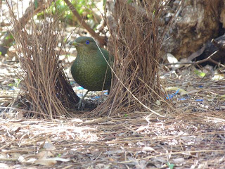
Because this is supposed to be a Nature Blog I'll start with a photo of nature: namely a Golden-mantled Ground -Squirrel (Citellus lateralis). I'm not sure where the photo was taken but the species is common through the higher country of the West.
 Our first camp was at Trinidad CO and was memorable for our first sighting of a rattlesnake, which duly rattled at us before all parties departed in peace. Our next was on the banks of the Rio Grande outside Taos NM. It was memorable for having some nice, albeit only thigh deep, swims. We checked out the art scene in the town and visited the Pueblo where the gate-dude didn't believe I didn't have a camera!
A pleasant stop at Santa Fe (much nicer than Taos) from which I can remember the Native Americans (possibly Pueblos) running an artefacts market in the Plaza and Hummingbirds everywhere. These days I would have two blog posts at least about this city but that was then.
We took a day trip to the Los Alamos laboratories, where the nuclear weapons that finished WWII were developed. I have few memories of what we saw there in the way of the history of the place, but do remember that it was very hot: somewhere over 100oF. Despite this there were many folk out jogging at lunchtime. (In many areas visited on this trip the daytime heat was pretty extreme but I don't remember it stopping us doing much. Being a lot younger than we are now, and being used to Adelaide Summer temperatures, explains that. Also there were generally some cool shady hills to retreat to!)
We continued on to Bandalier National Monument to check out the ruins of the old Pueblo culture.
Our next destination was Carlsbad for the Caverns.To get there we passed through Roswell NM. I am nowadays astonished to reveal that we made it through there without being abducted by aliens but in 1981 the conspiracy theories hadn't really got traction. (I am awaiting with bated breath for The Donald to claim that not only were the aliens real but one of them was actually Barack Obama's dad.)
We made it to the Caverns and did a cave tour. I recall this being a deluxe cave tour in which we descended by lift (elevator in Donald-speak) rather than ladders. Apparently the vertical distance is 230m so that was probably a Good Thing. Here are a couple of photos.

 We then basically headed across the bottom of the US. In those days, unlike we would now, we didn't have any interface with the Border Patrol (and I don't recall any warnings about illegal immigrants). Our first stop was at Alomogordo which had a space museum.
 Nearby is the White Sands NM. Apart from the white sand which was very spectacular. The area is known as being close to the Trinity Site where the folk from Los Alamos tested their work. We didn't go there - I suspect in 1981 it wasn't open to the public.

 We headed westwards across the bottom of New Mexico turning off to enter Chiricahua National Monument, which is actually in Arizona.
Historically the area is known as the preserve of the band of Apaches led by Cochise and Geronimo. To the East it is basically a sandstone area with escarpments and river valleys. On the western side it is a volcanic area with many pagodas (in Arizona called "Hoodoos") of volcanic tuff. I recall walking in the hoodoos feeling very glad I wasn't trying to track a guerrilla band of Native Americans through there!


Our next destination was the Grand Canyon. To get there we hit an Interstate and passed through Phoenix at about 10:30. Through the smog and heat haze we could just see an electronic sign outside a bank giving the temperature as 115oF. (How on earth do old folk with cardiac conditions live in this stuff? No wonder they all vote Republican: their brains have fried!)
I can't remember whether the car had air conditioning or not. I doubt it. The route basically crossed mountain ranges - quite cool and vegetated - then dropped into valleys which were desert and extraordinarily hot. Eventually we passed through Flagstaff and on to the Canyon.
The first sight of the Canyon was a blink through a gap in the mequite and was absolutely breath taking. The main campsite was full so we had to book a site there for later nights and go to a motel room for the first night. A nice little earner for the private sector concessionaires - who at that stage were still the Fred Harvey Company who first developed the area.
After a day spent en famille (that is not one of the famille in the image - Frances never owned a tee shirt like that) doing the South Rim...

.. on the next day I was up at 6 am and ran down the Bright Angel Trail through the Indian Garden campground to Plateau Point, from where I could down another 1,000 feet to the Colorado. This took an hour and was 6 miles from, and 3200 feet below, the start point (I was fairly fit in those days). I drank a quart of water as I ran down to Indian Garden and another quart going out to the point and back - which is effectively flat. By the time I got out to the Point my guess it was already well over 90oF and got a lot hotter, especially where the sun reflected off the cliffs all around the Trail.
The 4.5 miles back from the Gardens was a bit of a challenge. I walked with a German guy and we refilled our bottles 4 more times as we went up. I think we took about 4 hours to do the hike: the least pleasant bits were having to stand - in full sun - on the outside of the trail while the commercial mule teams laden with the obese and lethargic went by. On finishing I went back to our tent and had a nice sleep for about 3 hours until Frances returned from further tourism. I don't think I needed to piddle for the next 36 hours.
Next stop was the North Rim. To get there we drove along a fairly deserted road, with just the occasional Navajo ramada attempting to sell souvenirs to tourists (we'd already given at the Rim). At the point where the road crossed the Colorado we went to photograph the underside of the bridge. Due to the reflection off the bridge it was unbelievably hot down there: I think we ran back to the car, fearing actually burning like a bug under a magnifying glass.
My memory is that our next stop was Zion National Park. Again the entry was mind-blowing. In this case the road traversed some astonishing sandstone cliffs and then entered the valley in the guts of the Park through a tunnel. At various points windows had been blasted to the outside, giving glimpses of the stunning scenery. No photos have survived - possibly the reflectivity of the cliffs made the snaps susceptible to fading?
The highlight of this stop was getting an offer from a Mormon lady to look after Ingrid for the afternoon so that we - along with her husband and older kids (and some other folk) - could to a Ranger-guided walk up the Virgin River to the Narrows. This walk can't be done if there have been thunderstorms further up the catchment. When a flash flood comes down it can carry rocks the size of cars. The walk was incredible: we walked in the River, at times up to our waists in white water to a point where the canyon was 1,000 feet deep and 30 feet wide. It was nice and cool in there.
When we emerged and got back to the campground I wondered if the aliens had descended and taken everyone. (Of course they were all back at Roswell channeling David Duchovny.) The place was absolutely deserted. Then we went to the swimming hole on the River: literally everyone was in there sheltering from the 110+oF heat.
Next day it was a short trip to Bryce Canyon.

 The next bit of interest was driving through a pretty intense thunderstorm, which got a gully beside the road running with water. Eventually we, driving at about 60mph, caught up to the front of the flood going at about 30mph. This is the only time I have actually seen a flash flood in action!
Our aim was to get the Mesa Verde NM near the only place in the US where four States (CO,NM, UT and AR) meet. The main interest at Mesa Verde is the cliff dwellings left by the Anasazi. As it is very dry anyway, and the dwellings are sheltered by the cliffs, they are pretty well preserved.
 Getting to them was quite entertaining!
 Apparently the Indians didn't use ladders but climbed the rock. In the case of the women, with a few gallons of water balanced on their shoulders!
I'd pass on that!
The next day we went through Durango: another Wild West gunfighter place. The sign at the entrance to the town read something like "Welcome to Durango, home of Louis L'Amour and the Sackett family. Check your guns and lock up your womenfolk."
We passed through on the road to Silverton, which is known as the Million Dollar Highway. Three reasons are offered for this:
That is enough for one post. The second half is here..
They did 7200 miles in 30 days - a pretty serious bit of distance.
This made me think of the trips we did in 1981 when living in Denver. Frances initiated that idea by getting a book about the National Parks of the West and marking interesting places. I then worked out a route on a Rand-McNally Road Atlas (GPS was unknown then - as were iPhones, personal computers and the internet). From memory, taking nearly the whole Summer school holidays we covered about 10,000 miles in 70 days. Here, approximately, are our routes:


Anyway this caused me to reflect a little on our trip and with our friend's encouragement here is a summary of the voyage. It has been astonishing how doing this has caused me to remember (hopefully not too inaccurately) details of the trip.
I'll start by recalling that Ingrid, at the age of 4 years, handled the travelling really well. Occasionally we had to entertain her by:
- tales of the wicked witch who took naughty girls (occasionally the tales were accompanied by banging on the roof of the car to simulate a broomstick landing);
- my famous impressions of Bluebottle and The Famous Eccles from the Goon Show; and
- explanations of the descent of Princess Diana from a line of robber barons (this was mainly in the Northern leg so see part 2 for the justification of this)
As will be noted below some of the nice spots don't get a photo as they had faded over time and were thus unscannable. We traveled in a Plymouth station sedan, owned by the family with whom we exchanged jobs and houses, which got the job done, despite being woefully underpowered.
Because this is supposed to be a Nature Blog I'll start with a photo of nature: namely a Golden-mantled Ground -Squirrel (Citellus lateralis). I'm not sure where the photo was taken but the species is common through the higher country of the West.

A pleasant stop at Santa Fe (much nicer than Taos) from which I can remember the Native Americans (possibly Pueblos) running an artefacts market in the Plaza and Hummingbirds everywhere. These days I would have two blog posts at least about this city but that was then.
We took a day trip to the Los Alamos laboratories, where the nuclear weapons that finished WWII were developed. I have few memories of what we saw there in the way of the history of the place, but do remember that it was very hot: somewhere over 100oF. Despite this there were many folk out jogging at lunchtime. (In many areas visited on this trip the daytime heat was pretty extreme but I don't remember it stopping us doing much. Being a lot younger than we are now, and being used to Adelaide Summer temperatures, explains that. Also there were generally some cool shady hills to retreat to!)
We continued on to Bandalier National Monument to check out the ruins of the old Pueblo culture.
Our next destination was Carlsbad for the Caverns.To get there we passed through Roswell NM. I am nowadays astonished to reveal that we made it through there without being abducted by aliens but in 1981 the conspiracy theories hadn't really got traction. (I am awaiting with bated breath for The Donald to claim that not only were the aliens real but one of them was actually Barack Obama's dad.)
We made it to the Caverns and did a cave tour. I recall this being a deluxe cave tour in which we descended by lift (elevator in Donald-speak) rather than ladders. Apparently the vertical distance is 230m so that was probably a Good Thing. Here are a couple of photos.


Historically the area is known as the preserve of the band of Apaches led by Cochise and Geronimo. To the East it is basically a sandstone area with escarpments and river valleys. On the western side it is a volcanic area with many pagodas (in Arizona called "Hoodoos") of volcanic tuff. I recall walking in the hoodoos feeling very glad I wasn't trying to track a guerrilla band of Native Americans through there!

Biologically the area is known as one in which wildlife normally found in Mexico can be seen. This is because the animals travel along the relatively well vegetated mountains rising above the desert floor. Our example of this was a Trogon which was very exciting. Also exciting was having fireflies around our camp (at a site in one of the valleys) in the evening.
We crossed the route of the Butterfield Stage Company to visit Tombstone, one of the famous gunfighter sites of the Wild West. We didn't hang around for the re-enactment of the Gunfight at the OK Corral! We did visit their version of Boot Hill:

The inscription on the stone reads "Here lies Lester Moore. Four shots from a 44. No Les no more."
We didn't camp the next couple of nights but stayed in a motel in Tuscon, mainly because it was just too hot. My memory is that it was over 90oF by 8am. We went out to visit the Saguaro NM and marvel at the cactus.

(That snap was taken on a second visit, in 2006, but things hadn't changed much in 25 years.)
I can't remember whether the car had air conditioning or not. I doubt it. The route basically crossed mountain ranges - quite cool and vegetated - then dropped into valleys which were desert and extraordinarily hot. Eventually we passed through Flagstaff and on to the Canyon.
The first sight of the Canyon was a blink through a gap in the mequite and was absolutely breath taking. The main campsite was full so we had to book a site there for later nights and go to a motel room for the first night. A nice little earner for the private sector concessionaires - who at that stage were still the Fred Harvey Company who first developed the area.
After a day spent en famille (that is not one of the famille in the image - Frances never owned a tee shirt like that) doing the South Rim...

The 4.5 miles back from the Gardens was a bit of a challenge. I walked with a German guy and we refilled our bottles 4 more times as we went up. I think we took about 4 hours to do the hike: the least pleasant bits were having to stand - in full sun - on the outside of the trail while the commercial mule teams laden with the obese and lethargic went by. On finishing I went back to our tent and had a nice sleep for about 3 hours until Frances returned from further tourism. I don't think I needed to piddle for the next 36 hours.
Next stop was the North Rim. To get there we drove along a fairly deserted road, with just the occasional Navajo ramada attempting to sell souvenirs to tourists (we'd already given at the Rim). At the point where the road crossed the Colorado we went to photograph the underside of the bridge. Due to the reflection off the bridge it was unbelievably hot down there: I think we ran back to the car, fearing actually burning like a bug under a magnifying glass.
My memory is that our next stop was Zion National Park. Again the entry was mind-blowing. In this case the road traversed some astonishing sandstone cliffs and then entered the valley in the guts of the Park through a tunnel. At various points windows had been blasted to the outside, giving glimpses of the stunning scenery. No photos have survived - possibly the reflectivity of the cliffs made the snaps susceptible to fading?
The highlight of this stop was getting an offer from a Mormon lady to look after Ingrid for the afternoon so that we - along with her husband and older kids (and some other folk) - could to a Ranger-guided walk up the Virgin River to the Narrows. This walk can't be done if there have been thunderstorms further up the catchment. When a flash flood comes down it can carry rocks the size of cars. The walk was incredible: we walked in the River, at times up to our waists in white water to a point where the canyon was 1,000 feet deep and 30 feet wide. It was nice and cool in there.
When we emerged and got back to the campground I wondered if the aliens had descended and taken everyone. (Of course they were all back at Roswell channeling David Duchovny.) The place was absolutely deserted. Then we went to the swimming hole on the River: literally everyone was in there sheltering from the 110+oF heat.

This was sort of a cross between Zion (for rock colour) and Chiricahua (for the hoodoo structures). I didn't find it too exciting. The most interest aspect was chatting to an American family who had driven from LA that day (~500 miles). This wasn't to much stress for the father of the family as his job was flying B52s for the USAF. He had done a number of supply missions to Pine Gap in Australia (from memory, flying non-stop from California). He commented that they always had a few crew who had never seen a kangaroo, so once out of Sydney traffic control he would drop the plane to about 500 feet and go wildlife spotting!
I think it was while we were here that we went to a restaurant and found out about Mormon liquor laws. Frances wanted a Margherita but while the guy could bring her the mix to the table, she had to walk over to a bench in the corner of the room - which was a licensed outlet of the State Liquor Board - and get an unopened miniature of tequila. (The miniature had enough tequila for two drinks, and a second glass of mix could be delivered, so the process actually increased the amount of booze consumed.)
We were now on the homeward leg and drove across the Painted Desert the next day. We crossed the end of Lake Powell - noting some graffiti at Glen Canyon Dam to the effect that "Powell would have loathed this monstrosity".

Our aim was to get the Mesa Verde NM near the only place in the US where four States (CO,NM, UT and AR) meet. The main interest at Mesa Verde is the cliff dwellings left by the Anasazi. As it is very dry anyway, and the dwellings are sheltered by the cliffs, they are pretty well preserved.


I'd pass on that!
The next day we went through Durango: another Wild West gunfighter place. The sign at the entrance to the town read something like "Welcome to Durango, home of Louis L'Amour and the Sackett family. Check your guns and lock up your womenfolk."
We passed through on the road to Silverton, which is known as the Million Dollar Highway. Three reasons are offered for this:
- The road bed is made of highly mineralised rock which is worth a million dollars a mile.
- The road was difficult to build, costing $1 million per mile.
- The scenery is spectacular so the views are worth $1 million.
That is enough for one post. The second half is here..

Comments